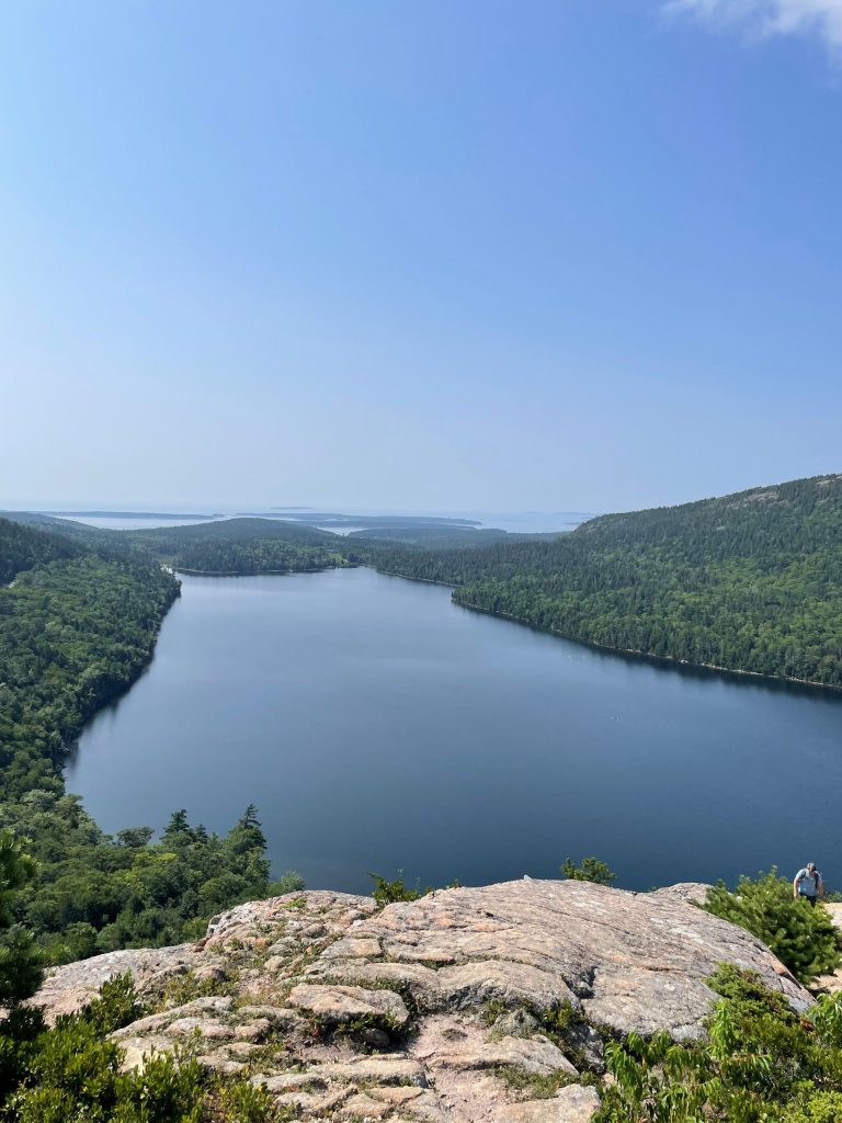
We maintain a portfolio of publicly and commercially available models, listed below.
Water Quality – CORMIX, GNOME, QUAL2E*, QUAL2K, CE-QUAL-W2, SWAT, SWMM, WASP, RMA4
Sediment Transport – PTM, STFATE*, MDFATE*
Hydrodynamics – ADCIRC, CMS-FLOW, EFDC, RIVER2D, RMA2
Hydrology & Hydraulics – BASINS, HEC-5Q*, HEC-HMS, HEC-RAS, HEC-RAS 2D, HSPF, HydroCAD, ICPR, WWHM
Wave – CGWAVE, CMS-WAVE, RUNUP, STWAVE, SWAN, WHAFIS
Groundwater – MODFLOW, WELFLO*
* Indicates a historical model that is not readily available to the public. Most historical model were developed or supported by federal agencies.
We specialize in numerical modeling of surface water and groundwater.
HWR’s work has been a part of flood studies, environmental impact assessments, NPDES permitting, TMDL studies, mixing zone requests, 316a demonstrations and variances, joint permit applications, state-level permitting, environmental remediation, and testimony.
Our programming expertise helps to set us apart from other professionals in our field. We are fluent in Python, R, Matlab, VBA, Javascript, and HTML. We differentiate ourselves by combining our modeling and technical expertise with our ability to efficiently access data and our skill at automating and performing state-of-the-art work. The more difficult the challenge, the more useful we are.
Projects
Pasquotank River, NC – Water Quality Modeling
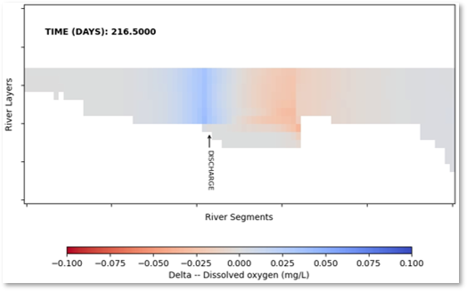
In support of the permitting for a new wastewater treatment facility (WWTF) in Camden County, NC, HWR developed a water quality model of the Pasquotank River. HWR worked with the project team to plan a field program. The field program provided an extensive dataset that helped the project team understand the complex dynamics of this “wind-dominated” estuary and water quality in the river throughout the year.
HWR developed a two-dimensional (vertical and longitudinal) of the river using CE-QUAL-W2. After calibrating the model against measurements from the field program, HWR applied the model to a range of scenarios. HWR worked with the project team to develop a conceptual design of the treatment train necessary for the effluent of the WWTF to meet the requirements of the state’s dissolved oxygen anti-degradation rule.
Grove Pond Aquifer Ayer, MA – Groundwater Modeling
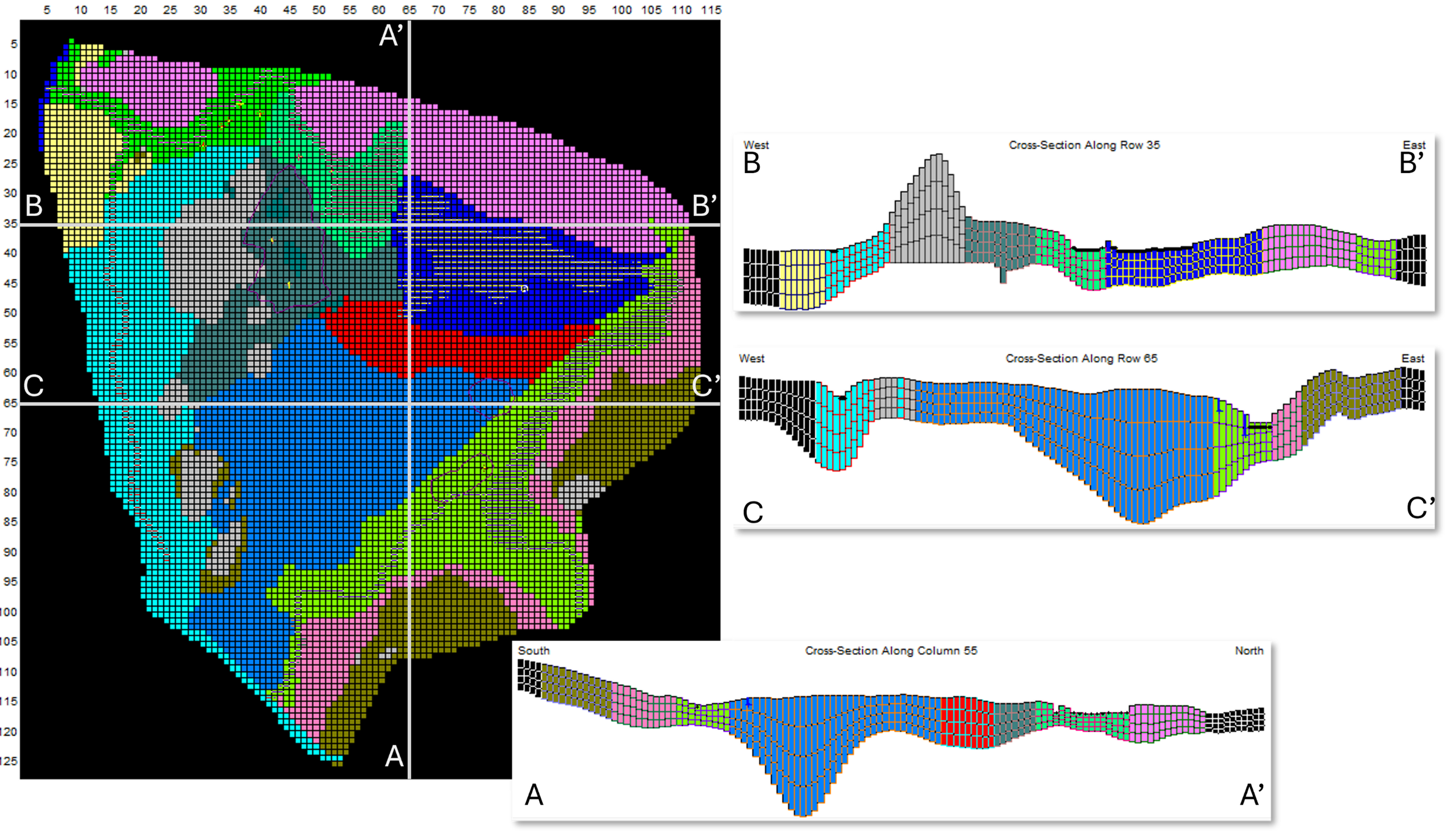
As a part of a national study investigating the human health effects of per- and polyfluoroalkyl substances (PFAS), HWR completed a historical reconstruction of groundwater concentrations of PFAS in the aquifers that supply public drinking water in the town of Ayer, MA. HWR worked with the project team to review sources, hydrogeology, and groundwater transport of PFAS. HWR used previous site investigations from the US Army Corps of Engineers and other consultants as the basis for new analysis of PFAS concentrations in groundwater. HWR developed three-dimensional MODFLOW-USG model for one aquifer and simulated the fate and transport of multiple PFAS to estimate historical concentrations of PFAS entering the drinking water system prior to the initiation of regular system testing.
Jacks Marsh Wareham, MA – Hydrology & Hydraulics
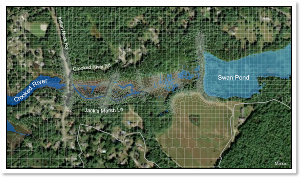
HWR supported the evaluation of restoration alternatives for a former cranberry bog in Wareham, MA. Jacks Marsh is a saltwater marsh that experiences reduced tidal exchange due to an undersized culvert that restricts flow into and out of the marsh. HWR developed a HEC-RAS 2D model of the marsh that included the culvert, wetting and drying of the marsh plain, and flow from Swan Pond. HWR provided technical guidance during planning. After completion of the field program calibrated the model. We then applied the model to a set of design alternatives to support decision making related to which design alternatives would provide the most sustainable restoration of the marsh.
St. Johns River, FL – Mixing Zone Analysis
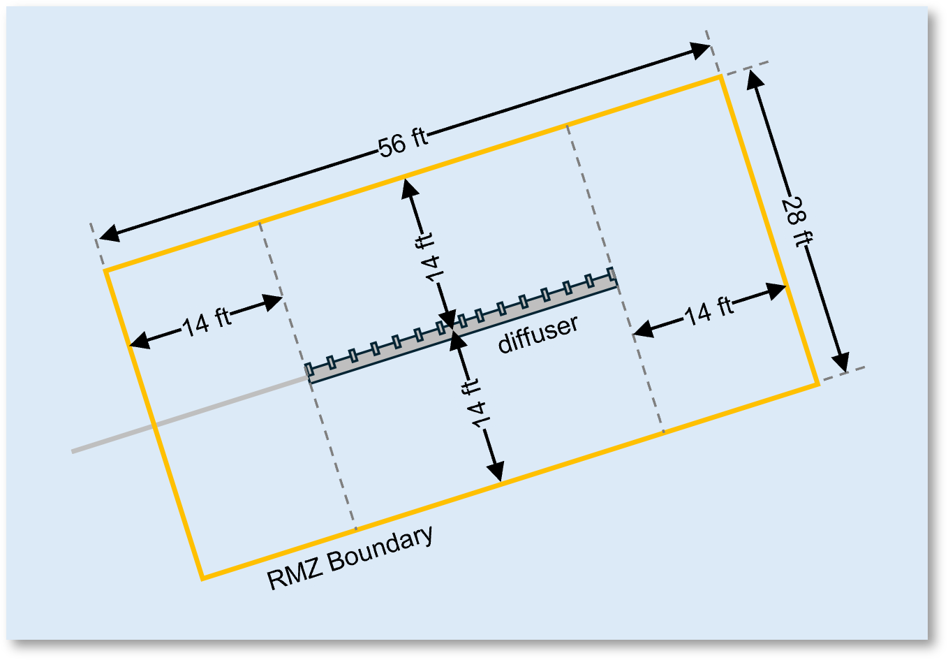
In support of the re-permitting of an industrial discharge to St. Johns River in Florida, HWR analyzed available information about the hydrodynamics and water quality of the St. Johns River to support the development of updated CORMIX modeling of the discharge. HWR worked with the client to determine an appropriate regulatory mixing zone (RMZ) for the existing multi-port diffuser. HWR identified critical ambient conditions for evaluation, and provided technical expertise through the re-permitting process including extensive work responding to questions and comments from the Florida Department of Environmental Protection.
Pequest River, NJ – Dam Removal Hydraulic Modeling
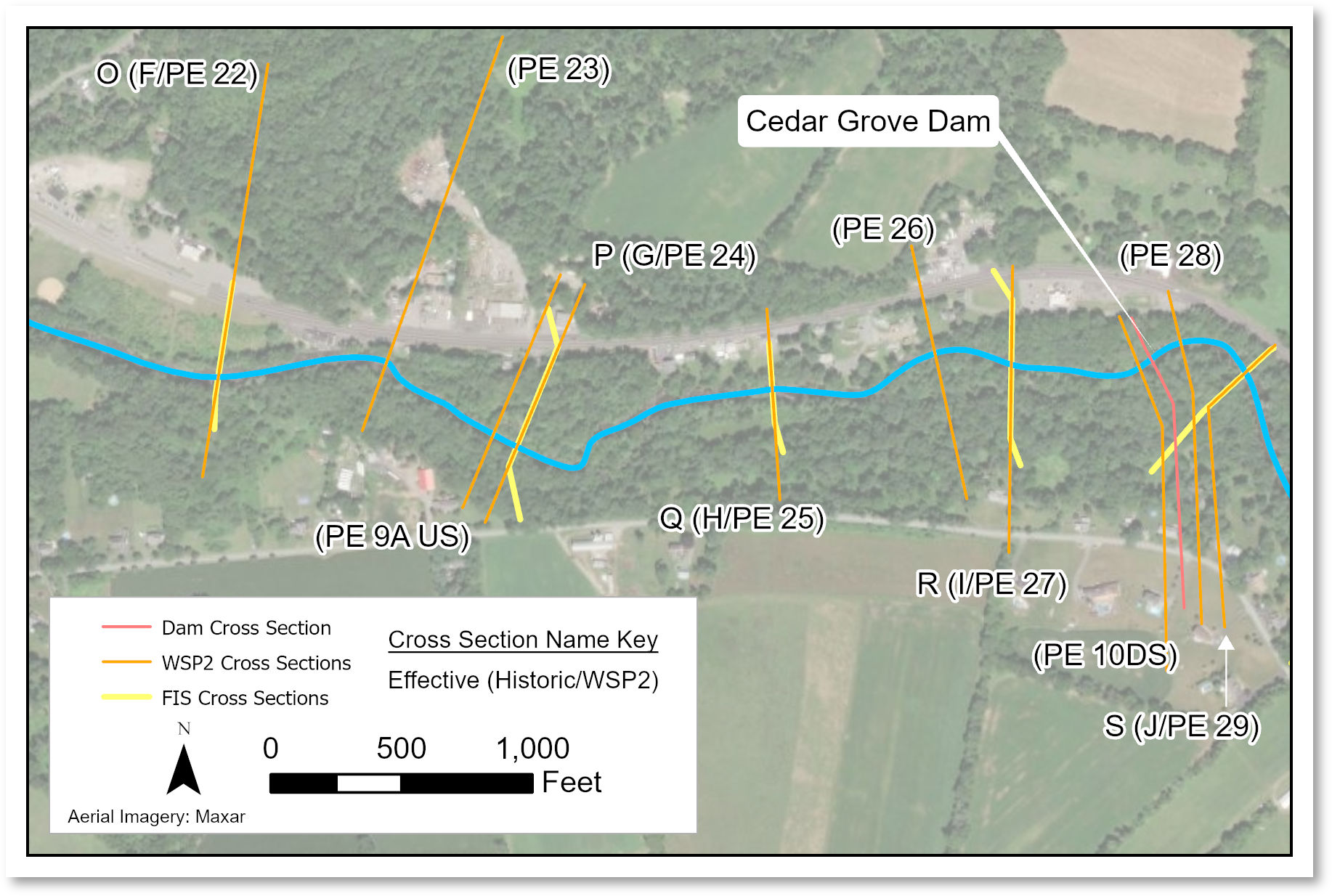
Working with a project team to restore diadromous fish passage on the Pequest River in New Jersey, HWR provided hydraulic modeling services in support of permitting the removal of the Cedar Grove Dam. HWR developed a HEC-RAS (1D) model of a portion of the Pequest River. HWR followed standard FEMA procedures by developing a duplicate effective model and then demonstrating no increase in flood elevations given the planned dam removal. HWR documented data sources and methodology in a technical memorandum that was part of the permitting application to the state.
New York/New Jersey Bight, NY – Sediment Transport Modeling
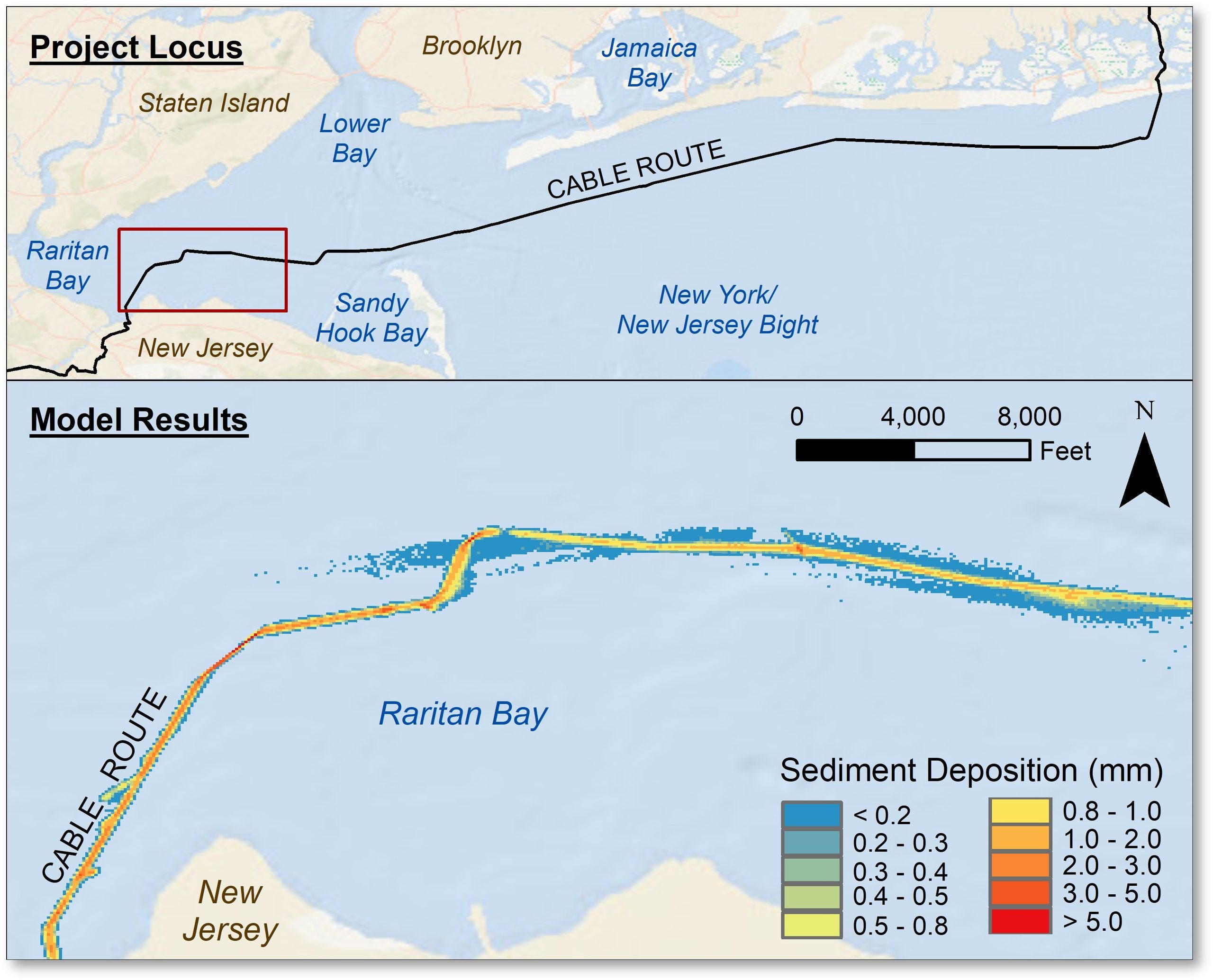
HWR has worked with many companies as they plan and implement utility expansions (e.g., offshore wind). As just one example, HWR supported the permitting of an offshore cable between New York and New Jersey through Raritan Bay and the New York Bight. HWR developed a two-dimensional model the region using ADCIRC. The ADCIRC model was couple to a NOAA regional forecasting model (NYOFS). We then simulated the movement of suspended sediment that was likely to result from jet plowing the submarine cable along the seafloor.
James River, VA – Salt Wedge Investigation
Data Analysis
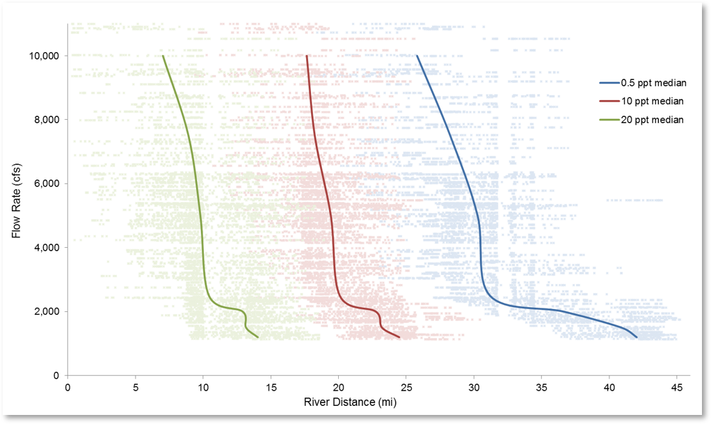
HWR studied the impact of a proposed water withdrawal on the salinity regime in the James River, VA. The withdrawal location was in the tidally-influenced portion of the James River, which feeds into the Chesapeake Bay. In lieu of developing our own model, we used results from the NOAA CBOFS model in our analysis. We investigated how isohaline position responds to variation in freshwater flows and tidal range. Our investigation led us to conclude that the salinity regime in the river is relatively insensitive to small changes in freshwater flow. HWR calculated how far upstream each isohaline would move in response to the proposed withdrawal.
Akutan Harbor, AK – Hydrodynamic Modeling
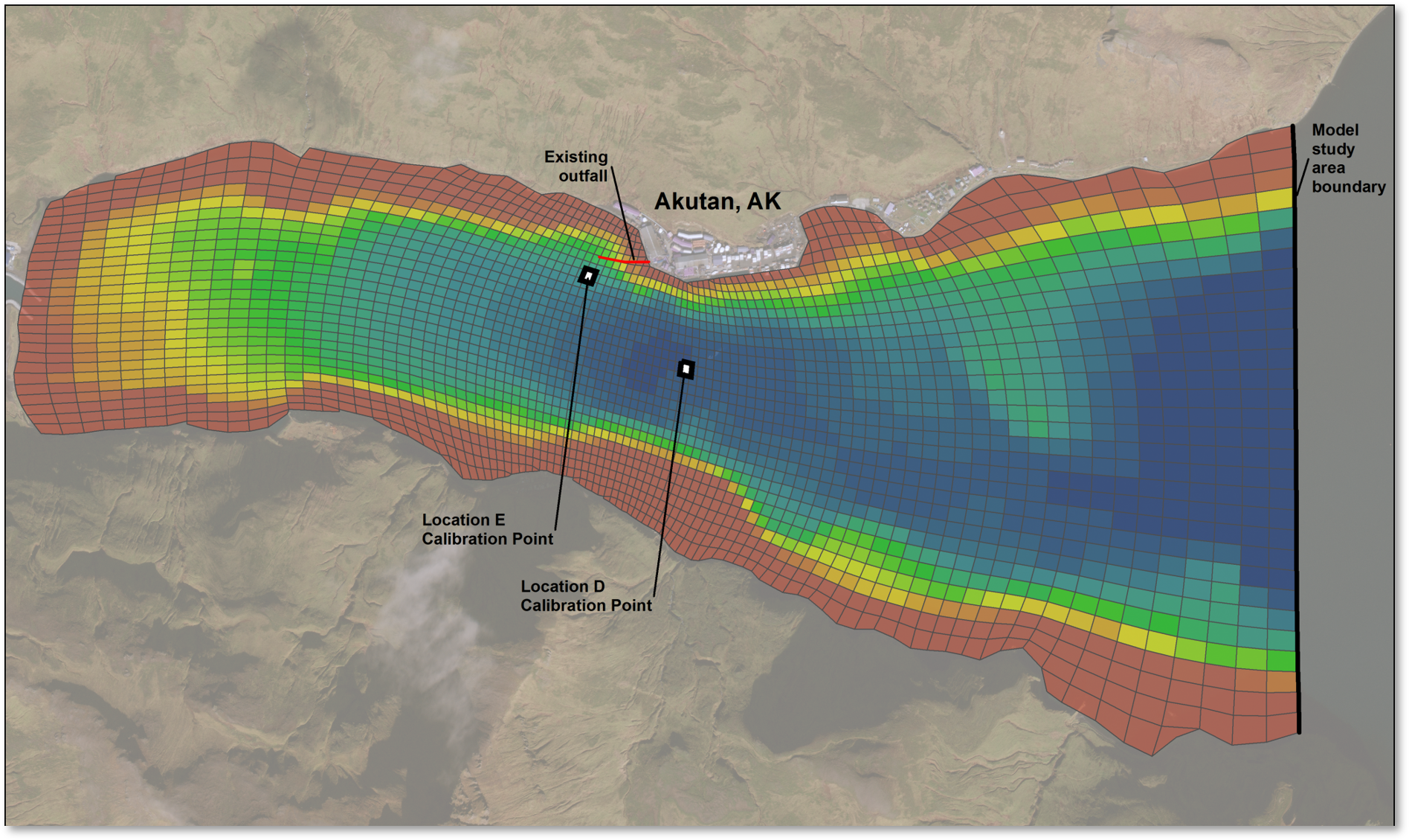
HWR was a part of a project team that conducted an outfall relocation study for a fish processing plant on an Alaskan harbor. We developed a three-dimensional hydrodynamic model of the harbor using EFDC. We calibrated the model to water level and velocity field data. Using the calibrated model, we simulated a dye tracer at different locations throughout the harbor to compare dilution to provide estimates of available dilution. The client considered the model results in conjunction with safety considerations to select a new optimal discharge location. The new location became a part of remediation strategies at the site
Massachusetts Bay, MA – Web Data Viewer
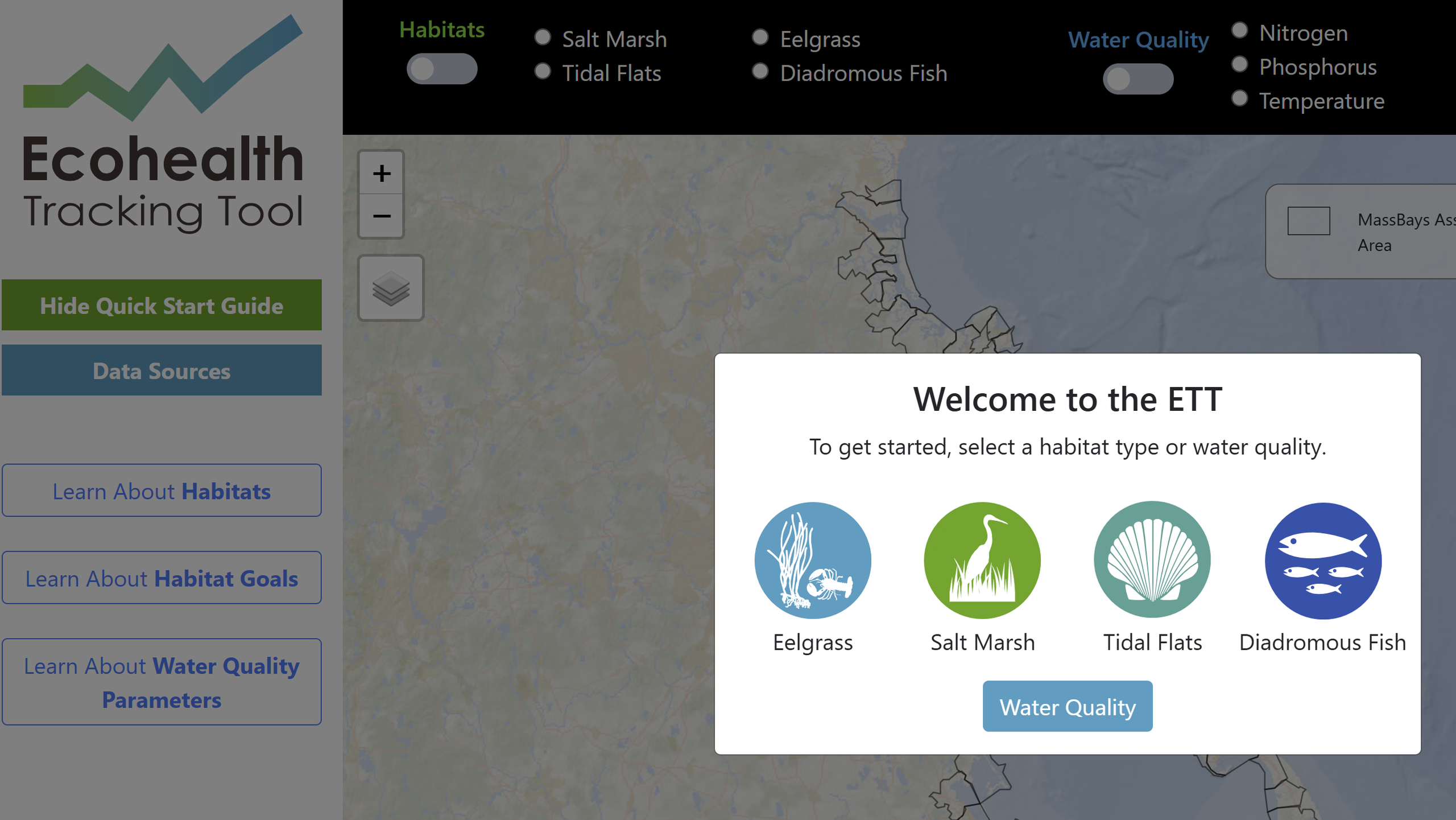
HWR is a part of a multi-disciplinary team that is developing MassBays Ecohealth Tracking Tool (ETT). One major component of the ETT is a web-based data explorer that marries ecosystem health measurements with water quality data. HWR served as the primary web developer of the data explorer. In this role, we used our knowledge of water quality and our quantitative and programming skills to support the development of an online tool that meets the identified needs of MassBays and their target audiences.